Thursday, December 7, 2017

Time to deal with it rather than ignore it.


    At this stage, we covered a decent amount of hazards that Morocco deals with. I wanted to choose two of the most dangerous hazards that I believe my country is in need to create a solution before its too late. These hazards I talked about them before and really think they are a danger to the safety of the country and could possibly end up in a crises, so I will give a summary with some statistics to help.

      As I wrote about it in my previous blogs, Morocco is a country that is located at the top of Africa, surrounded by the Atlantic ocean on the west, the Mediterranean from the north, and Algeria from the east. Seeing it on the map we might think that most of the problems or hazards come 
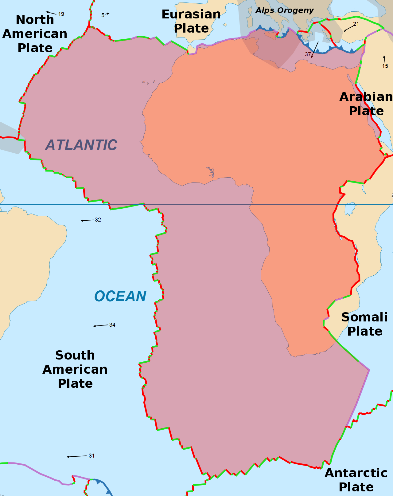
from the sea. However, is not the case. From the Tectonic plate blog, we discovered that northern part of Morocco lay on top of two plates boundaries, the African one, and Eurasian one. So we can immediately conclude that the first hazards that the country need to deal we and be prepared for all the time is earthquakes. The border plates are known as a transform fault, which means two tectonic plates slide past one another. Each year the African plate moves upwards to the Eurasian plate and that create friction and tension between each other; and eventually, that energy will be released under a form of waves under the earth surface, which generally make the earth move in a certain intensity and that what make the earthquakes deadly or not. The most affected area is the northern section of Morocco since it is in direct contact with the plate. In order to prevent a major disaster, here is some recommendation that would help: Have regular programmes in schools and advertisement that keep people aware of the danger and the step necessary in case of an emergency. Create research teams to monitor every activity possible near the plate boundaries, and provide necessary equipment and the latest technology in earthquakes to keep track of the data; that later would be combined with the historical data recorded for better prediction. Also, Create an emergency evacuation plan for the northern region that is being in the danger zone and has a high percentage of facing a major earthquake.

      Morocco never had to deal with hurricanes or cyclones even it has two coastal borders, but it recorded some severe storms, so I don’t think that is something the country is threatened by at this moment unless the climate changes are getting worst and disrupting the system. What Morocco need is a serious land management due to erosion.

   Erosion is the second hazards because it is present, and visible throughout the country’s land. Most of Morocco’s soils are fragile and subject to erosion. The country has scarce natural resources, especially arable land, and water. Intensive agricultural production, large-scale irrigation schemes, industrialization, and urbanization have been creating mixed outcomes in the country. In addition, from living there as an example, the country has faced severe problems of air, water and soil pollution, environmental health problems, deforestation and soil erosion and is regarded as very vulnerable to the impacts of climate change. Not only that, natural hazards such as floods and droughts occur periodically as I was able to explain in wildfires and drought forum. It is estimated that areas in the process of degradation affect the livelihoods and food security of about 1.5 million households in Morocco, who then further extend their agricultural production and livestock systems to other marginal and fragile lands, thus seriously further degrading the natural resource base. An economic analysis has estimated the global cost of lost productivity in Morocco as a result of land degradation at between USD 91 and 178 million per year.

   With a total land area of 71.085 million hectares, Morocco’s land use can be summarized as 5.8 million hectares of forests (8%), 9.2 million ha of agricultural lands (13%) and 46 million ha of pastures, rangelands, and deserts. The plant biodiversity in Morocco registers 4500 species, with 537 endemic species. This means the country lies in second place in terms of diversity in the Mediterranean basin after Turkey. What I want to mention as well, is that the southern part of Morocco is basically a desert, which is an unforgivable condition as we know. What makes this issue even more complicated is that the fact that the wind action transports eroded material above or along the surface of Earth either by turbulent flow or by laminar flow (in which adjacent sheets of air slip past one another); and that make the land more vulnerable. And in my opinion, the southern parts would be a priority area/region, to at least reduce the speed of the erosion process. An example of solution could be: buildings barriers, increase the number of trees planted and preserving any kind of vegetation that already exist to help, plus inform the citizens and educating them of how important it is to not destroy whats left.

    I would construct my house somewhere were there no possibility of having to deal with an earthquake for sure. So I would have my house exactly near where my family house is in right now ( the north-west of Morocco) and here is why. The city where my family lives is located in the number agricultural region of the country, so the natural resources like vegetation and water are available. Plus my city is forming a triangle that we call the economic triangle, which is a group of three cities (kenitra, Rabat, Casablanca) that are well developed and can cope with a disaster.Plus the necessary help and equipment would be much closer and have an easy access to it if I would have my house inland for example.


Note:  the statistic and some terminology were taken from these sources,
file:///C:/Users/Folio%20Ultrabook/AppData/Local/Packages/Microsoft.MicrosoftEdge_8wekyb3d8bbwe/TempState/Downloads/OASIS_2_Morocco.pdf
https://www.britannica.com/science/erosion-geology
http://geology.com/nsta/transform-plate-boundaries.shtml

Thursday, November 16, 2017

Earth and Sea: Coastal hazards.


Coastal Hazards are physical phenomena that expose a coastal area to risk of property damage, loss of life and environmental degradation. The risk that a natural hazard poses is considered by estimating the impact that it would have on the people, services, facilities, and structures in a coastal community. Risk is typically defined as “probability of an event x consequence” and the greater the frequency and/or impacts, the greater the risk.
Coastal hazards are caused by different mechanisms, producing ’drivers‘ that directly affect the coast. Coastal hazards can be grouped into categories:

·        coastal inundation (or flooding)

·        coastal erosion (cut-back) and accretion (too much sediment)

·        recreational and maritime hazards.

Coastal-hazard drivers come from storms, winds, sea-level changes due to climate variability (for example, seasonal and El Niño), and earthquakes that rupture the seabed (which can create tsunamis). 
1.     Flooding
Flooding may result from a coastal storm, dam break, or a heavy rainfall within the coastal watershed. Development continues to intensify within flood-prone and marginal areas along the coast or in coastal watersheds. Protecting floodplains preserves the natural functions of ecosystems and also helps prevent loss of life and property from damaging floods.
2.     Lake Levels
Low water levels present a hazard to navigation and water supply intakes, and limit riparian landowners’ access to the lake. High lake levels cause widespread flooding and bluff erosion. During these high water periods, storm surge and storm waves can cause severe property damage and shoreline erosion. Areas on the Great Lakes that experience chronic flood and erosion damages were typically constructed during times of low lake levels. 
3.     Storms
The main threats associated with these hazards are storm surge, high winds, heavy rain and flooding, as well as tornadoes. Winter storms can produce rough lake conditions, coastal flooding, and beach erosion. Strong winter storms are also responsible for significant land losses around the Great Lakes.
4.     Erosion
Coastal erosion is a process whereby large storms, flooding, strong wave action and human activities – such as inappropriate land use, alterations, and shore protection structures – wear away beaches and bluffs during a flood or storm or over a period of years. Erosion undermines and often destroys homes, businesses, and public infrastructure and can have long-term economic and social consequences.

Climate change will affect three out of the five causes of coastal hazards. Even tsunamis, which are generated by geological processes unaffected by climate change, will eventually pose a slightly larger threat because they will ride on top of a higher sea level.

    To understand the important role that the coast line paly here is an explanation. In its natural state, the coast acts as a buffer to the dynamic ocean colliding with a fixed landmass. The coast must at times absorb tremendous energy generated by large waves, severe winds, storms, and tsunamis – and take the rap over a very narrow buffer zone. Mostly, the coast absorbs this energy by wave-breaking in shallower water and by either flexing through the movement of large quantities of sand or gravel (causing beach erosion or accretion) or providing a barrier, such as a cliff or sand dune, high enough for gravity to halt the sea’s onslaught. When properties, infrastructure, and people get caught up in this buffer zone, these natural coastal processes become hazards. https://www.niwa.co.nz/publications/wa/vol15-no3-september-2007/coastal-hazards-rising-problems

   Since Morocco has 3500 km (2174.8 miles) of coastal lines, coastal hazards are common. Many areas face several damages mainly due to the lack of necessary defense mechanism. Some of the country’s coastal land is located below the sea level. the northeast of the country ( near a city named Nador) where many small islands start disappearing under water. Another example, The Tangier coastal strip of the northern coast of Morocco located at the western end of the Strait of Gibraltar between the Mediterranean Sea and the Atlantic Ocean; is at risk and that’s because the earthquakes that are generated from the tectonic plate of the African and Eurasian one. Not only that, the 1 November 1755 event is the most destructive tsunami ever reported along the Moroccan Atlantic coast. It was caused by an earthquake of magnitude 8.5 in some places the water penetrated more than 2000 m inland. The most recent tsunamis that were observed in Morocco without appreciable damage are those of 25 November 1941, and of 28 February 1969. The 1941 tsunami was triggered by a Mw 8.3 strike-slip earthquake in the Atlantic; the waves were recorded by the gauges in Casablanca and Essaouira with maximum amplitudes of 25 (9.8 inch) and 45 cm (17.7 inches), respectively.http://www.tandfonline.com/doi/full/10.1080/19475705.2013.858373

And in the last couple of year, morocco have seen some storm surges that pushed the water inland bringing with it debris from the sea, such as rocks from Crashing violent waves that hit the coastline. In the early hours of Friday, February 3, 2014, the coast of Salé and Casablanca were hit by very high waves.


the wave height reached 9 meters (29.5 foot), submerging neighborhoods and coastal areas of Sale, Rabat, Mohammedia, Casablanca, El Jadida, Safi, and Agadir. These have caused significant damage to several houses on the coastal road. Following these huge waves, roads were completely covered with mud and sand blocking the traffic for several hours. As for the inhabitants of the districts submerged by the waves, they were quickly evacuated. fortunately, no lives were taken except property damages and complete chaos.

In the city of Casablanca, which is the biggest city of Morocco, Coastal erosion and submersion will be particularly affected by the sea level rise indirectly provoked by global warming through the thermal expansion of water masses (dilation) and the melting of the polar ice cap, and a study showed that an overall sea level rise of 20cm by the year 2030. In the Casablanca region, the coastal stretch exposed to a high risk of erosion or submersion will remain approximately identical to the present situation, which is around 40km of coastline. The sea level rise will however slightly increase the risk of submersion of low-lying areas. 


http://www.cmimarseille.org/sites/default/files/newsite/library/files/en//UD2_wk2_Study_Morocco_ExecutiveSummaryPhase1_EN.pdf

In an attempt to limit this phenomenal, the Kingdom is launching multiple projects that re-construct the shape of the most vulnerable coast line by creating artificial islands and completely reshaping how the water is coming in contact with the land by reinforcing the sea wall. In addition, the country is also conducting several study areas that are potentially at risk, from forecasting system for waves and storm tide levels, use of real-time monitoring to update emergency managers on storm tide, waves, and tsunamis, developing models for estimating potential damage to the built environment to guide decisions on risk. These study will result in having a detailed map, Building classification based on primary (intrinsic) factors of vulnerability, and Damage matrix obtained for building vulnerability derived from the vulnerability functions.

Thursday, October 26, 2017

China and typhoons, a one of a kind relationship.


   This week we are getting on a journey of exploring weather, especially extreme weather. I'm going to break away from my regular home country as a topic and head to Asia this time.
     China, a country in east Asia with a population of 1.4 billion and the second largest state by land area of  3.7 million square miles. the climate in China varies greatly from south to north, especially in winter when dry and cold winds, blowing from Siberia and the Mongolian Plateau, lead to a huge temperature gap between south (above 0) and north (far below 0) China. The country climate is divided into six categories as follows: tropical, subtropical, warm-temperate, temperate, cold-temperate, and Qinghai-Tibet Plateau temperate zone. Most of the country lies in the northern temperate zone, which is characterized by warm climate and well-defined seasons, being suitable for habitation. https://www.chinatravel.com/facts/china-climate.htm


     Before we get into the details of china's extreme weather, let me give you an introduction of what's extreme weather is, and what type of weather do china constantly face.  Extreme weather refers to weather phenomena that are at the extremes of the historical distribution and are rare for a particular place and/or time, especially severe or unseasonal weather. Such extremes include severe thunderstorms; severe snowstorms, ice storms, blizzards, flooding, hurricanes, and high winds, and heat waves. https://www.ncbi.nlm.nih.gov/books/NBK45750/
    More specifically in extreme weather, there is what lately we've heard a lot about; Hurricanes, cyclones, and typhoons that are happening in different corners of the world, but what are they.? In a simple answer, they are all the same weather phenomenon; we just use different names for these storms in different places. In the Atlantic and Northeast Pacific, the term “hurricane” is used. The same type of disturbance in the Northwest Pacific is called a “typhoon” and “cyclones” occur in the South Pacific and Indian Ocean.

     China is well known for it industrial advances and a booming economy, but also for its direct path for powerful typhoons.Typhoons hit China more often than any other country in Asia. On the average, about 7 or 8 land each year. Since 2015 and 2016 has an unusually strong El Nino weather pattern, there has been an unusual number of strong typhoons landing in or coming near China. the Swiss Re's insurance company ranks Shanghai as 8th riskiest and the Pearl River Delta 3rd riskiest for major natural disaster in the whole world. Some other cities in the world face earthquakes, but China's coastal Shanghai Region and Guangzhou.

  • Note:  During an El Nino - when the central Pacific is warming - there are fewer Atlantic storms. El Ninos shift where storms form, but not the number, for the northwest Pacific and the southwest Pacific. The central Pacific gets more storms during El Nino and the year after.


       To explain a typhoon, is a large, strong, tropical cyclone. A cyclone is a low pressure area spinning counterclockwise and holding rising warm air that forms over warm water in the western Pacific Ocean. The winds from a typhoon can reach from 75 - 150 MPH. A super typhoon’s winds can reach up to 150+ MPH.   There are three main ingredients of a typhoon. 1. Warm water. 2. Moisture. 3. Inward spiraling winds. If the right conditions persist long enough, they can combine to produce the violent winds, incredible waves, torrential rains, and floods.
Typhoons start off as tropical thunderstorms. The strong winds pull in moisture from the oceans.

The thunderstorms convert the moisture into heat. The heat causes more air to flow to the centre of the storm causing evaporation.

All the heat and air flow toward the eye creating the typhoon.
     As I briefly talked about china's typhoons dilemma. This figure below shows the start of tropical cyclone records in 1946.  The last ''level No 10'' storm was Vicente, which hit in 2012. The No 10 signal was issued on July 24 and lasted for close to three hours. At least 138 people were injured.


Among them, Wanda, a typhoon which hit Hong Kong from late August to early September in 1962, was the deadliest. Wanda escalated to the level of a “super typhoon”, meaning its maximum sustained winds near the centre of the storm reached 185 km/h or above. At least 130 people were killed and 53 people were reported missing.
http://www.scmp.com/news/hong-kong/health-environment/article/2107903/brief-history-hong-kong-typhoons  


        China's methods of staying safe and mitigate an extreme weather scenario, in this case typhoons  in the areas of Hong Kong, Macau, Shanghai and Guangzhou they general use a similar system of warning. If a typhoon approaches, there are four warning signals that are broadcast for the public and it goes as follow:
  1. Signal blue: The signal is used when a storm with winds of 31 mph (50 kph) or slightly lower is 24 hours from the city and approaching. It is a warning to keep alert. 
  2. Signal yellow: A storm with winds of about 41 mph (66 kph) may arrive within 24 hours. 
  3. Signal orange: A storm with winds of about 58 mph (95 kph) is predicted to arrive within 12 hours. A signal orange might last for a day or less. This warning gives the public a chance to prepare their home or go to a safe place and all schools are closed. 
  4. Signal red: Expect a typhoon with winds of at least 72 mph (117 kph) to arrive within 6 hours. A signal red is rare. Destructive force is expected. Flights and bullet trains are generally canceled. cities are mainly endangered by typhoons.
   In case of a signal orange, make sure that your shelter can withstand possible gale or typhoon force winds and is not in a flood prone place. Consider leaving the city or getting a higher room in a hotel. You'll have a little time to move to a safer location. Stock some water and food to last a day or two, and have a portable radio, flashlights, batteries, and candles ready.
  If a typhoon hits the area, then stay away from windows. If you are on a bottom floor of a hotel or other building near sea level, try to move up to a higher floor to avoid any flooding. In case of a category 5 typhoon, the storm surge can rise more than 30 feet or three stories high, so try to get higher than this. Listen to public flood warnings.
After typhoon:
  • Be sure that the house/ building is safe and stable before you enter.
  • Beware of poisonous animals like snakes that may have entered your house.
  • Watch out for live wires or outlet immersed in water and report damaged electrical cables and fallen electric posts to authorities.
And as usual I'll finish my blog by a video. This one is from a news report about Typhoon Meranti  that hit china in 2016, show casing the destructive force a typhoon can be.


Thursday, October 12, 2017

The Land Is Sliding.


          From earthquakes, flooding, and volcanoes, we continue the chaine of earth’s geological events on the blog this week by introducing Mass Wasting.

Mass wasting is the process of erosion whereby rock, soil, and other earth materials move down a slope because of gravitational forces. It proceeds at variable rates of speed and is largely dependent on the water saturation levels and the steepness of the terrain. A destructive, rapid mass‐wasting event is called a landslide; if the movement is slow enough that it cannot be seen in motion, it is called creep. Three kinds of movement are generally recognized: flow, slip, and fall. A mass‐wasting event is called a flow if the mass moves downslope like a viscous fluid. If the mass moves as a solid unit along a surface or plane, it is called a slip. A slip that moves along a surface parallel to the slope is called a slide. If the movement occurs along a curved surface where the downward movement of the upper part of the mass leaves a steep scarp (cliff) and the bottom part is pushed outward along a more horizontal plane, it is called a slump. Earth material that free‐falls from a steep face or cliff is termed a fall.  https://www.cliffsnotes.com/study-guides/geology/mass-wasting/introduction-to-mass-wasting 

     To pinpoint dangerous regions, geologists look for landforms known to result from mass movements, for where these movements have happened in the past, they might happen again in the future. Features such as slump head scarps, swaths of forest in which trees have been tilted, piles of loose debris at the base of hills, and hummocky land surfaces all indicate recent mass wasting.


In some cases, geologists may also be able to detect regions that are beginning to move. For example :
·         roads, buildings, and pipes begin to crack over unstable ground.
·         Power lines may be too tight or too loose because the poles to which they are attached move together or apart. 
·         Visible cracks form on the ground at the potential head of a slump, and the ground may bulge up at the toe of the slump.
·         In some cases, subsurface cracks may drain the water from an area and kill off vegetation, whereas in other areas land may sink and form a swamp. 
·         Slow movements cause trees to develop pronounced curves at their base. 
More recently, new extremely precise surveying technologies have permitted geologists to detect the beginnings of mass movements that may not yet have visibly affected the land surface.http://geologylearn.blogspot.com/2015/12/how-can-we-protect-against-mass.html 
       Mass wasting events are caused by gravity in combination with a variety of geologic, climatic, and in some cases human factors. One other factor which is often associated with dramatic mass wasting events is vegetative cover and particularly sudden changes to vegetative cover by fire or human activities. Particularly large scale mass wasting events frequently follow forest fires and heavy rains on steep slopes. Although it is impossible to anticipate all mass wasting events being aware of the factors which contribute to such events is essential to avoiding them.
       Climate can have a dramatic influence on mass wasting events. Areas with a moist temperate climate are subjected to frequent freeze and thaw cycles. Freeze-thaw cycles affect rocks because when water seeps into cracks in a rock and then freezes it expands putting tremendous pressure (24 tons per ft2) on the rock, forcing the cracks to expand. Over time this type of physical weathering can cause even the strongest rocks to break apart. Sometimes this process is referred to as frost heaving or freeze thaw action. Thermal expansion and contraction of rock bodies also may occur in areas with extreme temperature variations and this likewise affects the stability of rock. Moisture, in addition to its influence through freeze thaw cycles (physical weathering,) can actually dissolve some of the minerals that rocks are made of. This is called chemical weathering and it also affects the stability of rocks. Sometimes large mass wasting events (or large numbers of smaller events) are associated with heavy rains. Heavy precipitation can initiate certain types of mass wasting by creating hydrostatic pressure and serve to lubricate slides once they are in motion.
      Certain human activities are known to affect mass wasting, many of the potential problems can be avoided by using good land use planning techniques and engineering solutions where appropriate. Drainage diversion and irrigation projects may destabilize slopes and increase the probability of mass wasting by increasing the moisture in vulnerable areas. Likewise hillside excavation which changes slope gradient could destabilize slopes making them prone to mass wasting. Blasting, often associated with mining or construction activities, can result in vibrations and air blasts which may trigger mass wasting events. Other human activities which could potentially impact mass wasting include transportation vibration, increasing the load that the ground must bear (especially on slopes,) changing vegetative cover, and pumping. https://www.nature.nps.gov/geology/hazards/mass_wasting.cfm 
     Mass Wasting in my country, Morocco, is common even though it isn’t reported in the media; mostly because they happen in remote ares where the people don’t live. Unless it occurred in a known place.
The only time that I was able to see what mass wasting could cause as damages, was in the city where I lived in Morocco, couple of block from my house. It happened in 2007, when a project of buildings was under construction in a land that turns into a small lake during heavy rain in the winter. The team responsible for the project decided it was a good idea to create a wall of rock to stop the water from gathering in that location, and at the same time it will enforce the land. What they didn't know, or ignored, was that the land was already soaked with water. When they start building the complex, the land couldn’t handle the weight on top of it, so it slides bringing the buildings with her to the ground; leaving multiple deaths and a completely useful site. Till this day, the authorities can’t go into the site to remove the debris or demolish the rest of the buildings because they don’t what will happen. Instead, they surrounded the area with a metal like a wall so no one will enter it.
    An anther mass wasting that was i able to find was in Arroumd ( central Atlas Mountains of Morocco) as a Rock Avalanche.  The landslide itself have originated from the steep slopes in the background, traveled down the side valley and been deposited in the valley floor and in part in the main valley.  The resulting deposit has blocked the main valley to a degree. The image below shows the landslide deposit and the village from upstream. 
To prevent mass wasting,
Morocco has a region which is known for having many landslides. The Zoumi sector of the Moroccan Rif was used in a study because of the frequency and distribution of the landslides that take place.
 

The idea behind the study was to create a susceptibility map. This map will assist in providing needed information to better plan, protect the people and property when it comes to the rebuilding of structures and roads after the occurrence of such mass movements.

  1. Avoidance is the best method for limiting mass wasting hazards. It is recommended that people stay away from and limit development in areas prone to rock falls and landslides if possible.
  2. Good land use and geohazard planning employing appropriate geologic maps is recommended prior to development activity in areas prone to mass wasting.
  3. Engineering solutions may be appropriate for minimizing mass wasting hazards in certain situations, examples of such solutions include; removing the hazard through blasting or stabilizing the hazard using, rock bolts, mesh, steel, retaining walls, gabions, tension cables, grout, drains, etc. Other engineering solutions may not eliminate or stabilize the hazard but rather work to minimize or control rock fall and landslide run-out areas with ditches, specially designed tension cable nets, and talus walls.
  4. Ensuring that projects in mass wasting prone areas have proper drainage is also crucial to minimizing potential hazards.
  5. Proper maintenance and inspection of mass wasting prone areas is essential to spotting potential hazards.


Saturday, September 23, 2017

Volcanoes

   Having a country near tectonic plates raises the chance or experiencing some of the most amazing natural hazards in my opinion, Volcanoes. I’ve always loved and had a deep passion for this kind of hazards, it si a mix of fear and breathtaking of its greatness.

     Volcanoes are an opening for the inner part of the earth that create a vent for the magma to escape. They a result of the earth crust friction and submerging under one another causing the rock to melt, and they are usually formed where the plates meet ( 90% of the volcanoes are located in the ring of fire). While the crust is going down it releases heat and other earth elements from the melting rocks, which create a pressure chamber under the earth surface and then it starts to expand, and start to push upward on the earth surface. This process shapes the surface to create the shape of the volcano. Once the chamber can no longer hold the pressure it explodes/erupted and the lava ( the melting rock) escape to form a new land.

    As on my earthquakes blog, we learned that Morocco is on the central north edge of the African plate. This location allows the country to experience a transformed fault between the Eurasian and the African plate. Due to the plates activity in the thousands years ago, volcanism occurred in the Alboran Sea (West and East basins), between Morocco and Spain, and over to the South Balearic Basin. They are now dormant, but millions of years ago was an area of intense volcanic activity, and that was part of the shifting and friction when the earth was moving around and about. The known volcanoes present in Morocco are few and most of them are extinct. However, the El Arraiche mud volcano field is currently active on the Moroccan Atlantic slope that consists of 8 mud volcanoes in water depths from 200 to 700m .  http://www.sciencedirect.com/science/article/pii/S0025322705001301

    There are also volcanic flows in the High Atlas mountains of Morocco associated with the geologic CAMP event - CAMP (Central Atlantic Magmatic Province) was an incredibly massive eruption of flood-basalt type lava that occurred only a few million years after Pangaea began to break up. It covered 10 million square kilometers, leaving its products on 4 continents: North and South America, southwest Europe, and west Africa. The flows of the High Atlas Mountains, are associated with Moroccan Meseta eruptions at roughly millions of years ago as well.
https://answers.yahoo.com/question/index?qid=20091204113057AA8bHAd 

v  Note : The Atlas Mountains are the largest and most important mountain range in North Africa, extending from Morocco to Tunisia for about 2,400 kilometers (1,488 miles) in a series of creased mountain chains. Morocco's portion of the Atlas Mountains includes the Middle Atlas, High Atlas, and Anti-Atlas.  http://www.nationsencyclopedia.com/geography/Morocco-to-Slovakia/Morocco.html#ixzz4tLjIsnzo

     The remainder of the massive volcanoes that erupted during the Pangea is in the Anti-Atlas range. The Jbel ( means mountain in Arabic) Siroua South of the Atlas, a volcanic outcropping and a ridge of black lava that connects the High Atlas and Anti-Atlas. Siroua mountain is a stratovolcano, also known as a composite volcano, is a conical volcano built up by many layers (strata) of hardened lava, tephra, pumice, and volcanic ash. Unlike shield volcanoes, stratovolcanoes are characterized by a steep profile and periodic explosive eruptions and effusive eruptions. And another one would be Jbel Saghro are two of these ancient volcanoeshttps://en.wikipedia.org/wiki/Stratovolcano


     There is also a complex of a dozen volcanoes south of Azrou and Ifrane in the Middle Atlas region ( in the central region of Morocco) Jbel El Koudiate, Jbel Tamarrakoit, Jbel Outgui ; these extinct shield volcano usually built almost entirely of fluid lava flows. They are named for their low profile, the three main volcanic structures of the region. The most famous of these volcanoes is Michlifen, which is better known now for its ski station where tourist and locals visit each in winter.


    Since then Morocco never saw or recorded another volcanic eruption, in fact, most of the population don’t know that the country did experience volcanoes millions of years ago. The next picture is an explanation and details of the different component that goes into a volcano.


   And if you are a visual person and want to see how all the stages unfold watch the video, it is really interesting and I hope it will raise your passion for volcanoes as me because as much as destructive they can be sometimes, as much they are awesome and vital for new lands.
https://www.youtube.com/watch?v=WgktM2luLok


Friday, September 8, 2017

When earth decide to shake itself ( earthquakes)


    As we learned from the previous blogs Morocco is located at the northern tip of the African continent. Due to the position of the country it share a transformed fault that's between the African plate and the Eurasian plate.  The most natural hazards that we ( morocco) experience are earthquakes.
labeled faultBy definition earthquake is a results of two blocks of the earth suddenly slip past one another. The surface where they slip is called the fault or fault plane. The location below the earth’s surface where the earthquake starts is called the hypocenter, and the location directly above it on the surface of the earth is called the epicenter.

  tectonic plates   While the edges of faults are stuck together, and the rest of the block is moving, the energy that would normally cause the blocks to slide past one another is being stored up. When the force of the moving blocks finally overcomes the friction of the jagged edges of the fault and it unsticks, all that stored up energy is released. The energy radiates outward from the fault in all directions in the form of seismic waves like ripples on a pond. The seismic waves shake the earth as they move through it, and when the waves reach the earth’s surface, they shake the ground and anything on it.  https://earthquake.usgs.gov/learn/kids/eqscience.php
P & S waves
     The most damaging earthquake the Morocco has ever witness was in 1960, in a city named Agadir is located in western Morocco on the shore of the Atlantic Ocean. the earthquake's moderate magnitude of 5.7, its maximum perceived intensity was X (Extreme) on the Mercalli intensity scale. Between 12,000 and 15,000 people (about a third of the city's population of the time) were killed and another 12,000 injured with at least 35,000 people left homeless, making it the most destructive and deadliest earthquake in Moroccan history.  https://en.wikipedia.org/wiki/1960_Agadir_earthquake

    The country experienced more earthquakes obviously over the years across its land, but nothing was damaging as the one in Agadir. The next link is a website that keeps track of quakes that happened in Morocco in the last 30 days or so. At the time of checking it the most recorded activity was location around the north of Morocco, which is normal and expected as the area is where the transform fault is passing from.  --=>     https://earthquaketrack.com/p/morocco/recent

Friday, September 1, 2017

Morocco and Plate boundaries.


    This week discussion is about plate tectonics and how the plate boundaries effect the country of my choice. My pick was Morocco and here is a tiny introduction about it. Morocco a country located at the tip of the African continent who is known as, the door to Africa. Morocco is stretching across 3500km as coast on the Atlantic ocean from the west and the Mediterranean Sea to the north, where Europe is only 13 kilometers or 8.1 mi span of water.


     Plate tectonics is a bed or a floor that lies under the visible earth surface that we live on. In a scientific definition, plate tectonics theory dealing with the dynamics of Earth’s outer shell, the lithosphere, that revolutionized Earth sciences by providing a uniform context for understanding mountain-building processes, volcanoes, and earthquakes, as well as understanding the evolution of Earth’s surface and reconstructing its past continental and oceanic configurations. https://www.britannica.com/science/plate-tectonics

     The wide shape of the plate where the country is positioned played a role in the type of boundary. Morocco has only one unique direct boundary plate with the Eurasian plate on the north. On the book, Natural Hazards pg. 33 figure 2.4, it shows that the border is a transform fault, which means two tectonic plates slide past one another and The next image portray how it happen.
Oceanic ridges offset by transform faults and fracture zones. The arrows show the direction of movement across the transform faults.

     On the other hand, the African plate has several boundaries. The western side of the African Plate is a divergent boundary with the North American Plate to the north and the South American Plate to the south, which forms the central and southern part of the Mid-Atlantic Ridge. The African plate is bounded on the northeast by the Arabian Plate, the southeast by the Somali Plate, the north by the Eurasian Plate, the Aegean Sea Plate, and the Anatolian Plate, and on the south by the Antarctic Plate, as the next picture shows.  
The image above (in black and white) indicate high tension points that creates a type of hazards along side the African plate boundary with other plates.

     Referring to my last blog about natural hazards. I mentioned Geologic hazards like: earthquake, volcanic eruptions, avalanche and landslide, this type of hazards especially earthquakes and volcanic eruptions are usually related to the movement of tectonics plates; which create a zone of ring of fire. Morocco’s experience in geological events resume in earthquakes on its northern borders, and no volcanic activity known. The major hazard that's related to tectonic movements was an earthquake in a city called Al Hocaima in February of 2004 ‘’ The 6.5-magnitude quake, which shook the Strait of Gibraltar, just off the northern coast of Morocco. It was centered in an area 185 miles (295 km) ‘’. Between 628 and 631 people were killed, 926 were injured, and up to 15,000 people were made homeless. http://www.cnn.com/2004/WORLD/africa/02/24/morocco.quake/
     In the end, I would like all the readers to watch  the next video, which is an explanation of the dynamic of the earth plates. it is a fun and interesting short clip and you'll learn more about the type of boundaries. Enjoy it  !

https://www.youtube.com/watch?v=OinfMLdornU