This week discussion is about plate tectonics and how the plate boundaries effect the country of my choice. My pick was Morocco and here is a tiny introduction about it. Morocco a
country located at the tip of the African continent who is known as, the door
to Africa. Morocco is stretching across 3500km as coast on the Atlantic ocean
from the west and the Mediterranean Sea to the north, where Europe is only 13 kilometers or 8.1 mi
span of water.

Plate tectonics is a bed or a floor that lies under the visible earth surface that we live on. In a scientific definition, plate tectonics theory dealing with the dynamics of Earth’s outer shell, the lithosphere, that
revolutionized Earth sciences by providing a uniform context for understanding
mountain-building processes, volcanoes, and earthquakes, as well as understanding
the evolution of Earth’s surface and reconstructing its past continental and
oceanic configurations. https://www.britannica.com/science/plate-tectonics
The wide shape of
the plate where the country is positioned played a role in the type of boundary. Morocco has only one unique direct boundary
plate with the Eurasian plate on the north. On the book, Natural Hazards pg. 33
figure 2.4, it shows that the border is a transform fault, which means two
tectonic plates slide past one another and The next image portray how it happen.

On the other hand,
the African plate has several boundaries. The western side of the African Plate is a
divergent boundary with the North American Plate to the north and the South
American Plate to the south, which forms the central and southern part of the
Mid-Atlantic Ridge. The African plate is bounded on the northeast by the
Arabian Plate, the southeast by the Somali Plate, the north by the Eurasian
Plate, the Aegean Sea Plate, and the Anatolian Plate, and on the south by the
Antarctic Plate, as the next picture shows.

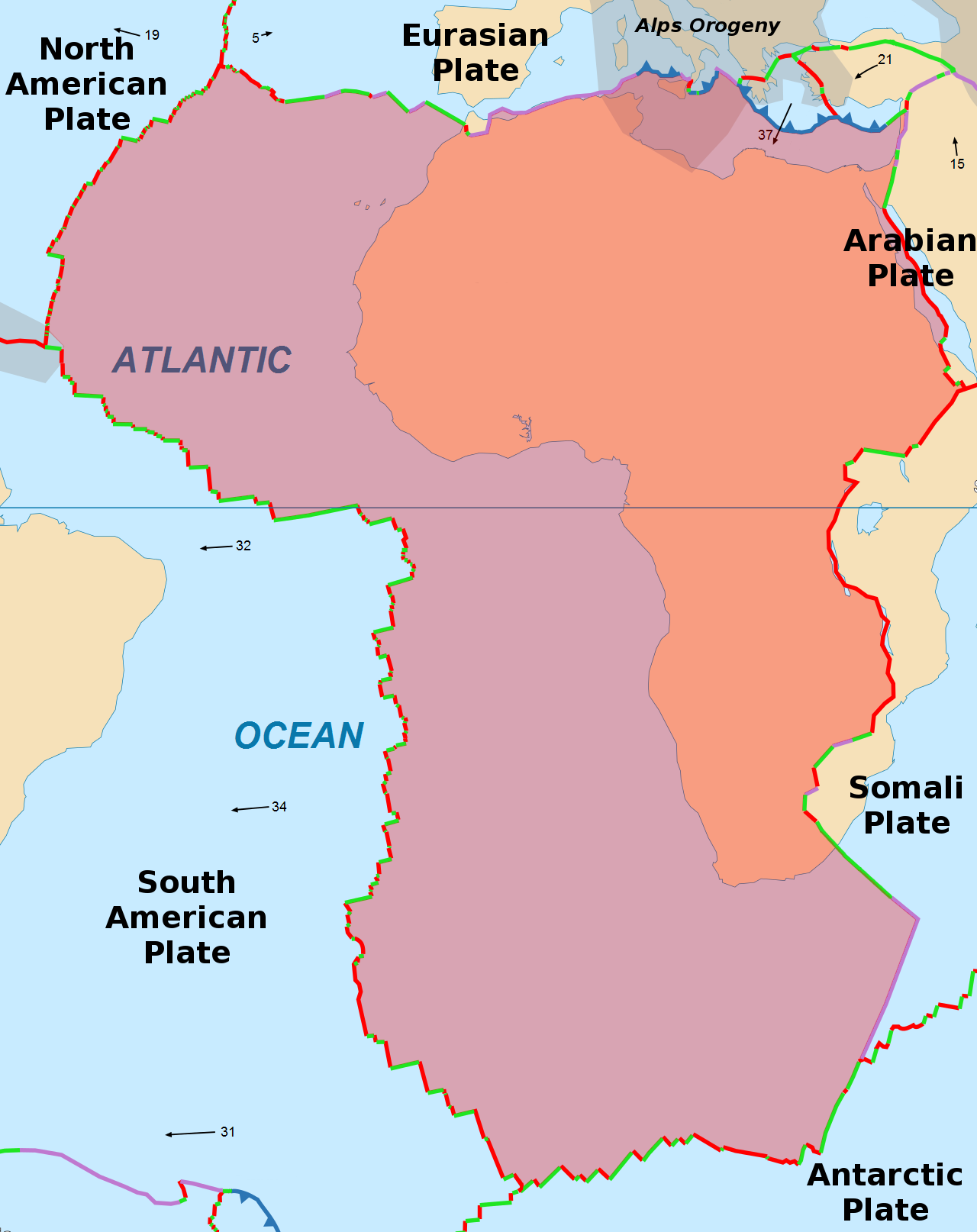
The image above (in black and white) indicate high tension points that creates a type of hazards along side the African plate boundary with other plates.
Referring to my
last blog about natural hazards. I mentioned Geologic hazards like: earthquake,
volcanic eruptions, avalanche and landslide, this type of hazards especially
earthquakes and volcanic eruptions are usually related to the movement of
tectonics plates; which create a zone of ring of fire. Morocco’s experience in geological events resume in earthquakes on its northern borders, and no volcanic activity known. The major hazard that's related to
tectonic movements was an earthquake in a city called Al Hocaima in February of 2004 ‘’ The
6.5-magnitude quake, which shook the Strait of Gibraltar, just off the northern
coast of Morocco. It was centered in an area 185 miles (295 km) ‘’. Between 628 and 631 people were killed, 926 were injured, and up to 15,000 people were made homeless. http://www.cnn.com/2004/WORLD/africa/02/24/morocco.quake/
In the end, I
would like all the readers to watch the next video, which is an
explanation of the dynamic of the earth plates. it is a fun and interesting
short clip and you'll learn more about the type of boundaries. Enjoy it !
No comments:
Post a Comment